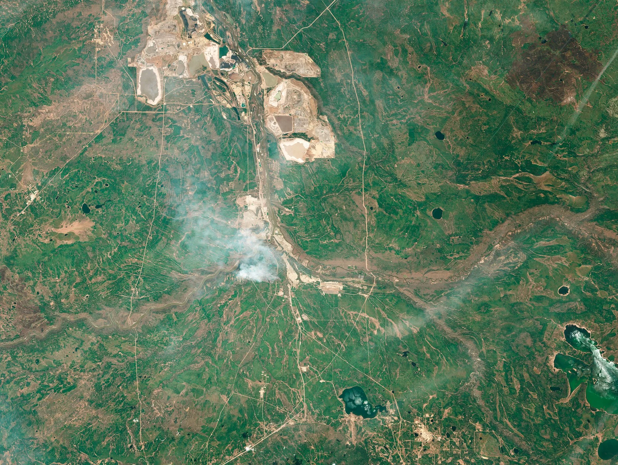
The first plumes of smoke southeast of Fort McMurray on 2 May 2016. Within the next 48 hours, the fire became supercharged, creating a fire cloud that released lightning up to 20 kilometres away. Soon after the satellite passed over this region, all 80,000 residents of the urban service centre were evacuated with little or no warning.
© Alan McFetridge, CEP and ESA
Burn Scars
This sequence of satellite photography shows a 12-month cycle from May 2016 to May 2017. At the beginning moment, this catastrophic fire is building up, you can see the first plume and a vast landscape that appears to be dry with large areas of exposed brown earth visible. What do you see in the sequence as the annual temperatures of the Boreal range from -40C to +30C?
This set of images links to ground photography in Songs of the Dead as we continue to build the case study of the Fort McMurray wildfire of 2016. Our primary aim is to provide information about the scale of the Boreal/Taiga and why is it an area of extreme importance to critical global infrastructure and the global fire crisis.
Our data science team - Eriz Yusuf and Mohamed Mazy, have created a tool to convert satellite data from ESA and NASA into imagery. These are our first outputs as we continue to send our work back to Fort McMurray for feedback.

1 July 2016, the fire then spread over 589,000 Hectares in 30 days
© Alan McFetridge, CEP and ESA
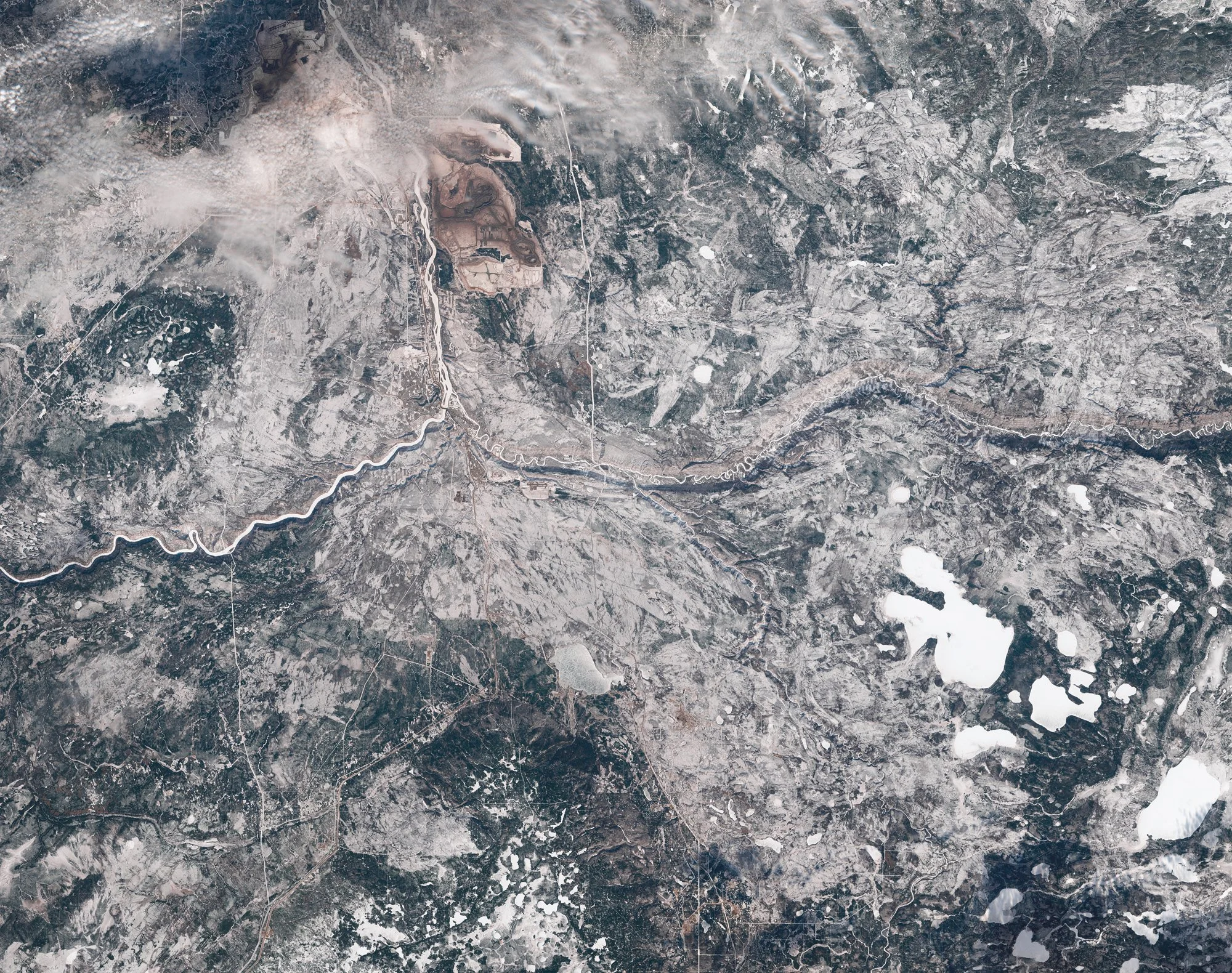
Mid-winter, 16 February 2017. The burn scar remains visible as the burnt forest tree canopy has altered. Holdover fires, fires that continue to smoulder under snow cover during the winter and reappear the following spring - could become much more common with more peat fires.
© Alan McFetridge, CEP and ESA
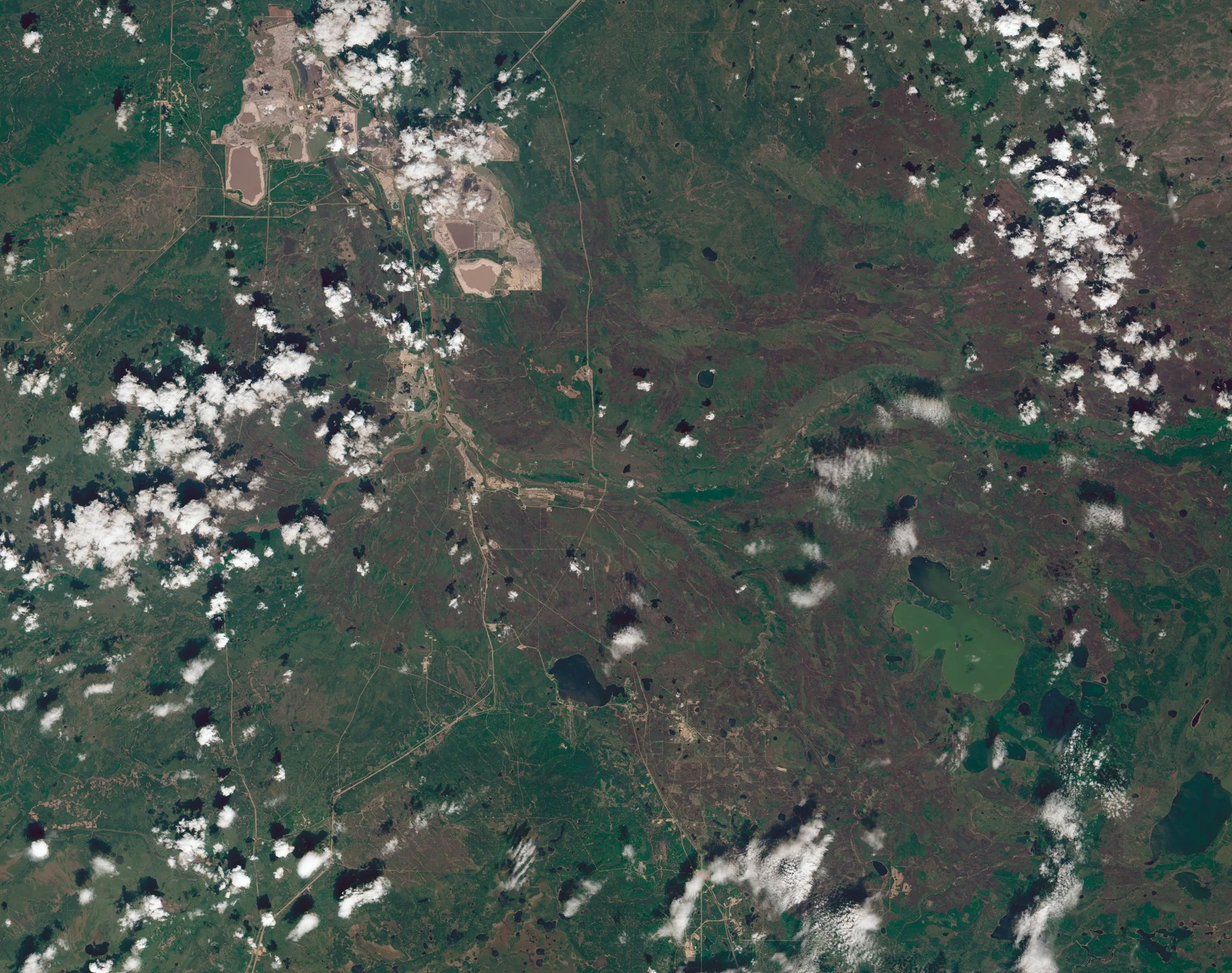
27 May 2017. 12 months later, the landscape appearance shows the burn scar, recovery and indication that 12 months earlier, it was much drier as the brown earth shows through.\
© Alan McFetridge, CEP and ESA
Scaled Mapping
For reference the 589,000 hectare Fort McMurray Fire burn scar was mapped over London, Athens, Paris and Sydney. Consider that estimates are that an average of over 2 million hectares burn annually in Canada ( Stocks et al., 2002). Climate change is having an impact on fire weather scenarios such as temperature, soil moisture and increased lighting strikes.


Four Bands, 2019 © Alan McFetridge
Fire from a Different Perspective
You can read more about our Data Science Teams mission to build tools for public use.
Songs of the Dead | Upcoming Monograph

As the planet heats, fires will worsen as a result of anthropogenic climate change.
To explain the complexity I found in the aftermath at Fort McMurray’s Horse River Wildfires of 2016, this monograph has been forming away on the studio with a range of iterations which have become realised.
If you would like to support Songs of the Dead you can become a patron on Patreon
You can read a more detailed blog post by Antoinette Johnson, here.
Left: Design and Partnership Invitation - Please email here to enquire about hosting a talk
For further information on this project please contact the Studio
All images © Alan McFetridge